Maps to Megawatts™
Award-winning technology delivering unparalleled accountability.
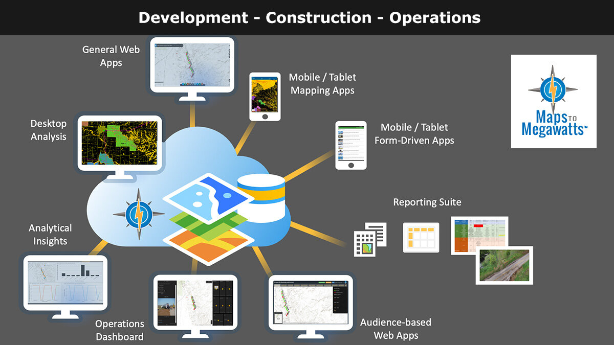
Maps to Megawatts™ is an advanced, subscription-based solution designed to streamline renewable energy development, construction, and operations.
Powered by the ArcGIS platform.
Note: This demo is recommended for viewing on desktops only.

Development
At the earliest stages of renewable energy projects, Maps to Megawatts™ empowers wind, solar, and transmission developers with advanced data analytics, streamlined information sharing, and seamless transitions from development to construction.
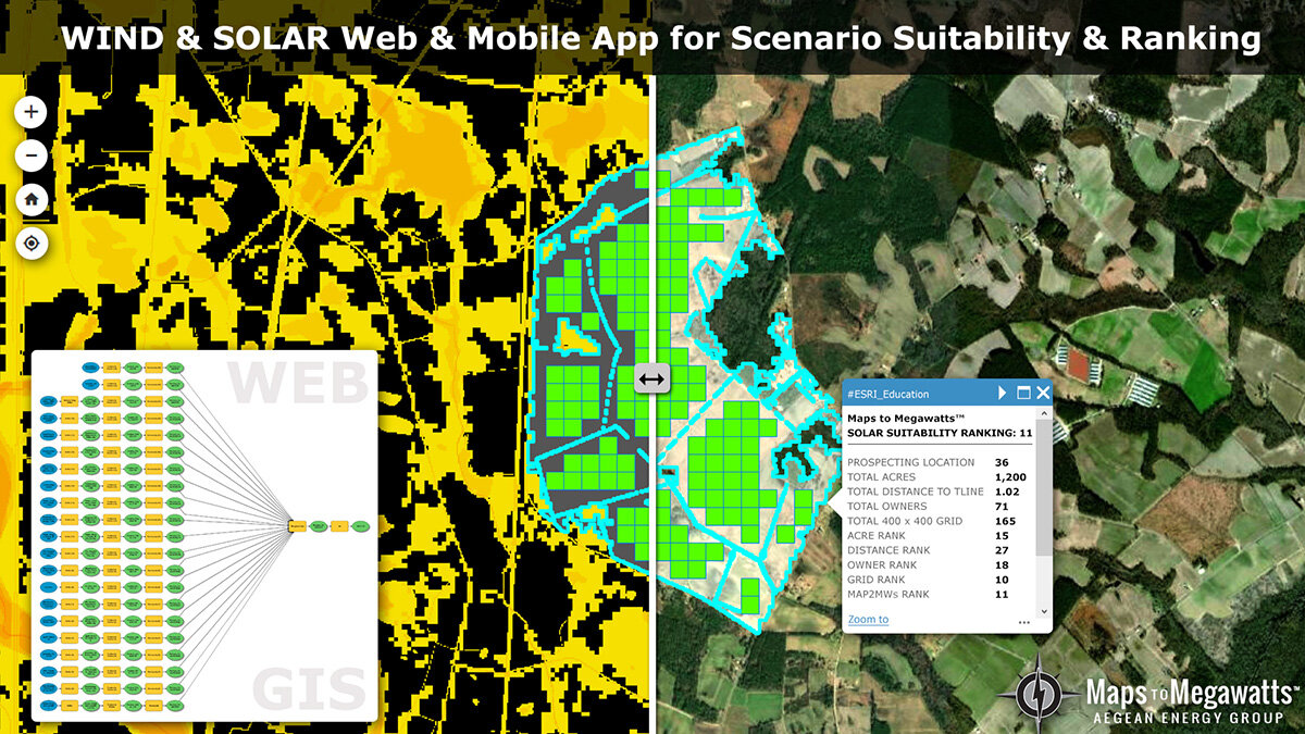
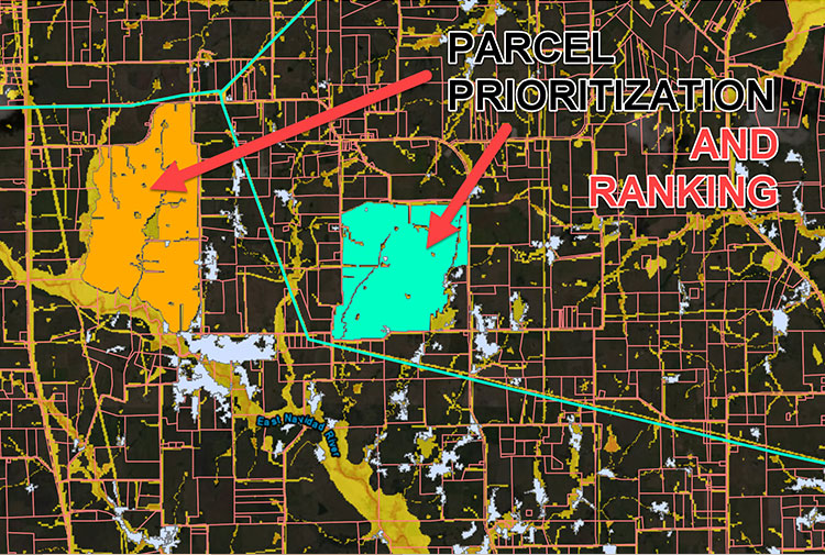
Site Analysis
Identify optimal locations for renewable energy projects while navigating environmental, logistical, and regulatory constraints.
Site Control and Reporting
Customize web maps and dashboards to track project data in real time, ensuring a smooth handoff from development to construction and beyond.
Connecting In-House Teams and Contractors
Facilitate collaboration with landmen, surveyors, and contractors through an integrated platform that links proposed crossings, civil issues, avoidance areas, and more directly from the field.

Construction
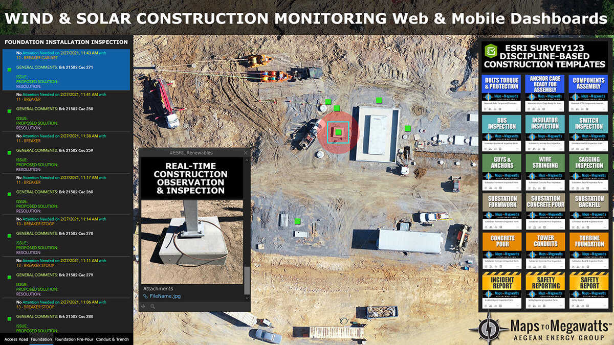
During construction, the Maps to Megawatts™ solution provides comprehensive document control, status reporting, and advanced real-time analytics—accessible on both web and mobile platforms.
Tools & REPORTS
Aegean delivers a suite of tailored project monitoring templates and forms designed for mobile use. These tools streamline daily, weekly, and monthly reporting, ensuring your project stays on track and meets critical milestones.
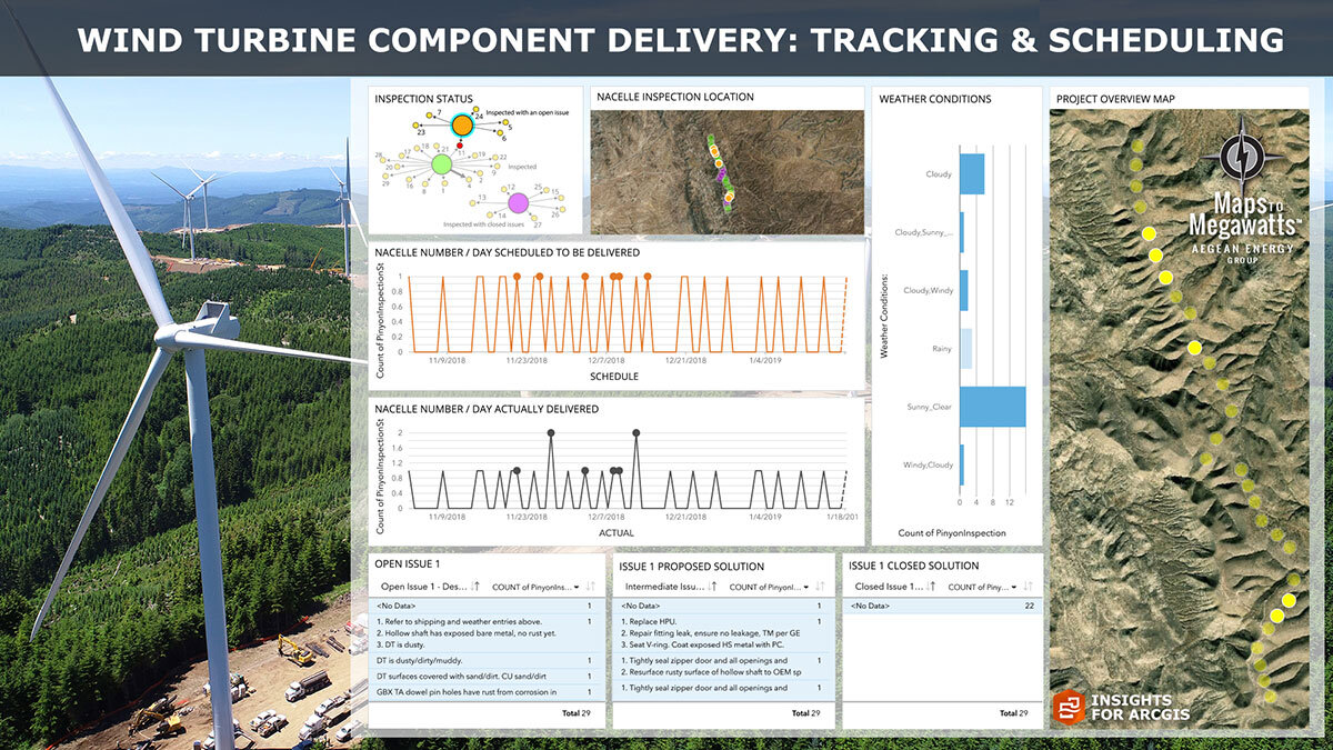
The Big Picture
With Maps to Megawatts™, seeing the "big picture" is simple. Track project progress using 3D modeling, video, and detailed historical data. Visualize your project as though you're flying over it, while ensuring every team member has access to the latest updates.
All project data is securely delivered through an integrated suite of online applications, keeping everyone connected and informed throughout the construction process.

Operations
After construction, the Maps to Megawatts™ solution continues to deliver value throughout the life of your project. Plant operators can use the platform to monitor all site assets and functions with fully customizable forms tailored to their specific needs.
To enhance reporting and oversight, a long-term drone program can be implemented, providing continuous data collection and analysis. From asset management to operational efficiency, Maps to Megawatts™ ensures seamless monitoring and reliable insights for the ongoing success of your renewable energy investments.

Maps to Megawatts™: Streamlined Insights, Seamless Operations
The Maps to Megawatts™ app is an intuitive solution that empowers teams to collect, analyze, and visualize project data effortlessly. From field surveys to real-time reporting, it ensures accuracy and efficiency at every stage of renewable energy development and construction.
With advanced features like geolocation-enabled forms, multimedia data integration, and offline functionality, it’s designed to optimize workflows, enhance collaboration, and provide actionable insights for your project’s success.
Explore the AusterMesa Demo
Dive into the Maps to Megawatts™ platform to experience its powerful tools for data collection, analysis, and decision-making. The AusterMesa Demo highlights geospatial insights, dynamic forms, and actionable dashboards tailored for renewable energy projects.
Note: The demo is best experienced on desktop devices for full functionality.